Warm and dry Fiji continues today!
The large scale features from yesterday all seem to persist. There wont be a radar animation on today’s post, because it shows no activity at all.
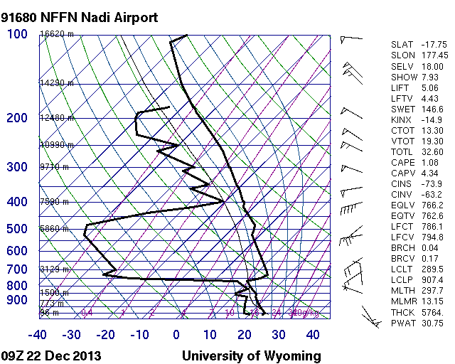
The atmospheric sounding is shown below. The prominent drying starts at around 750mb, or 2000 meters. This leads to a total of 30.75 mm of precipitable water over the islands, still significantly lower than what was the norm a few weeks ago. Winds aloft are out of the west, and strong.
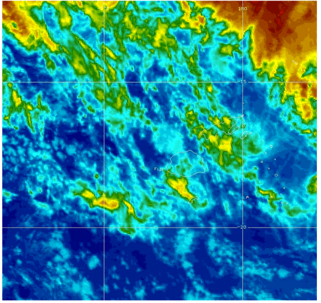
The colorized infrared radar shows most of the activity is off the north east coast of the islands, with scattered clouds across the archipelago. In combination with the upper air winds, it is hard to imagine a huge influx of moisture over the islands today. That being said, as tropical islands are, there should be some scattered rain throughout the day.
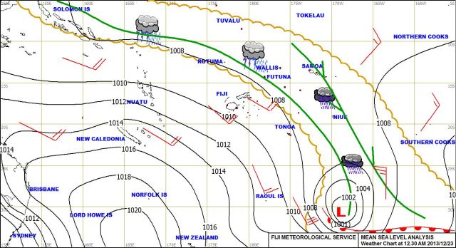
The surface level analysis shows the same low and high pressure centers off to the south east and south west, respectively. The low pressure system has strengthened, which contributes to the strong winds over the islands.


